Building an interactive mapping experience that could handle route and location data cleanly.


RouteYC
A web and mobile platform providing interactive maps, routes, and subscription-based access to tourism and location-based content across the Yorkshire coast.
RouteYC was created to promote tourism on the Yorkshire coast through a range of driving, walking, and cycling routes, presented through a digital platform that works for visitors both before and during their trip.
The platform needed to combine interactive mapping, curated location content, and flexible subscription access into one product, supporting visitors, business owners, and administrators from the same system.
The challenge was to present location-based information clearly within a map interface while managing access tiers, content updates, and user interaction across web and mobile.
Building an interactive mapping experience that could handle route and location data cleanly.
Structuring and presenting location-based content in a way that stayed usable within the map interface.
Supporting subscription-based access so enhanced features could generate ongoing income.
Allowing visitors to filter by accessibility, facilities, and opening status in real time.
Enabling business owners to manage their own listings without depending on admin resource.
Building a scalable platform that could grow in routes, content, and users over time.
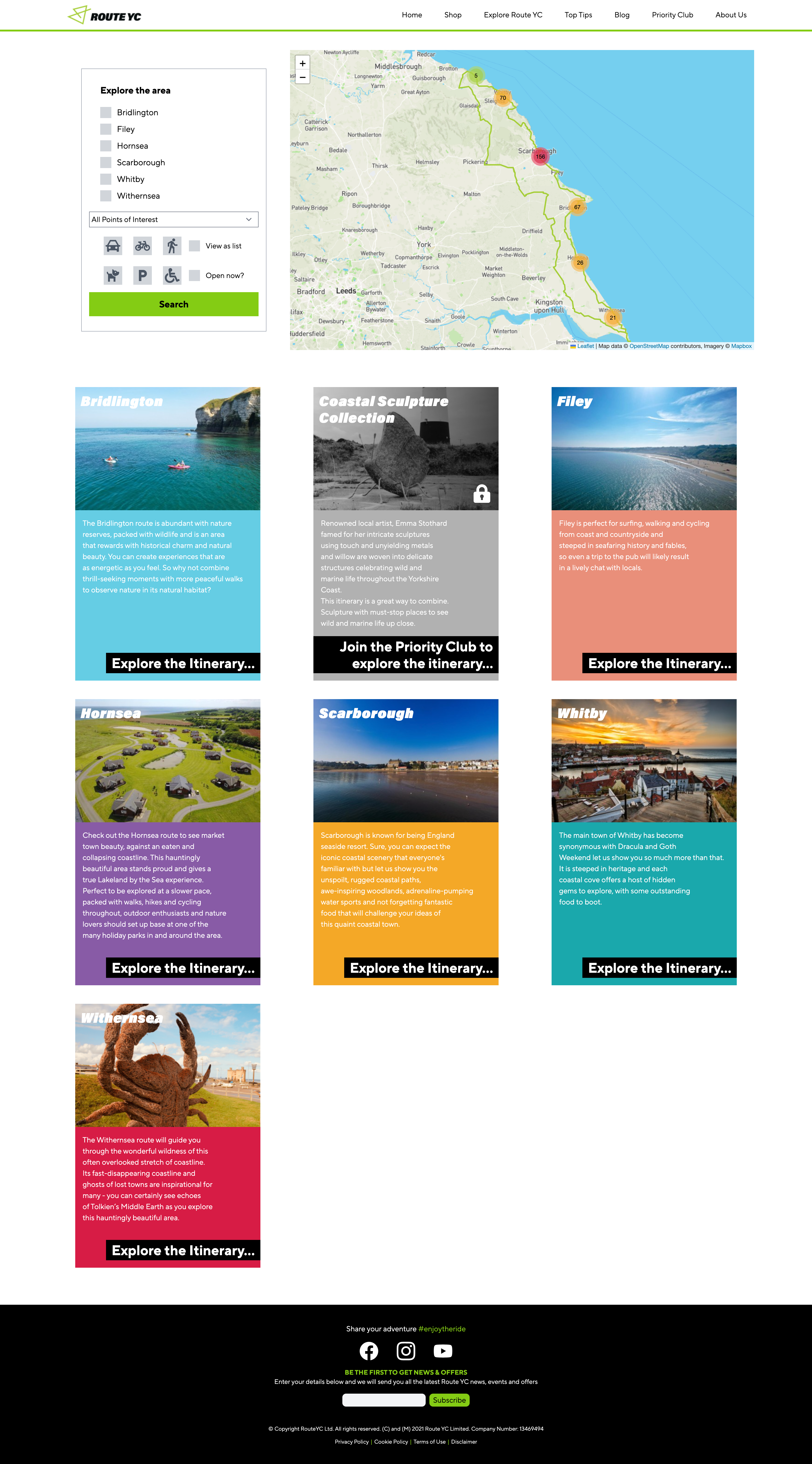
A map interface was built to present routes, itineraries, and points of interest across the Yorkshire coast geography.
Driving, walking, and cycling routes are structured and stored so they can be displayed and navigated clearly within the map.
Visitors can filter the map by accessibility, dog-friendly status, parking, and current opening times.
A subscription layer controls access to enhanced features, with users able to manage payments, renewals, and cancellations independently.
Business owners can update their own listings, keeping content current without requiring admin involvement.
A bespoke CMS gives administrators full control over the website, map, routes, and points of interest.
The platform is built to support further routes, content, and users as the project develops.
Visitors can explore routes, towns, and points of interest through an interactive map experience.
Location data is managed and presented consistently across the platform.
Subscribers can manage their own access without needing support from the RouteYC team.
Filtering by accessibility, facilities, and live opening times makes the platform more useful in the field.
The underlying structure supports future expansion in routes, content, and user base.
Need a platform that brings content and users together?
Talk to us about your systems →We will give you a straight answer on how we can help. No pitch. No template proposal.